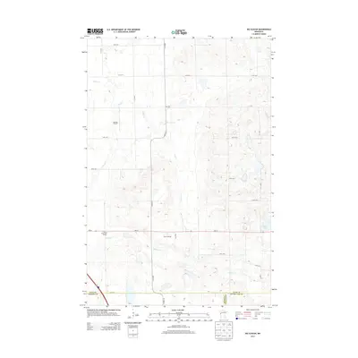
2013 Map of Big Slough
USGS Topo · Published 2013About this map
Spring Creek meanders through the northwest corner of this Clay County landscape, where the agricultural grid meets the subtle relief of the glacial plains. This area, located near the borders of Wilkin and Otter Tail counties, is defined by its extensive system of section roads and scattered prairie wetlands. The map documents the rural infrastructure of the early 21st century, illustrating how natural drainage patterns like Spring Cr still influence the layout of the surrounding farmland. Modern elevation data reveals the gentle undulations of the terrain, providing a clear picture of the water management and land use within this portion of western Minnesota.
Find a feature on this map
1 named feature on this map. Tap any name to fly to it.
Don’t see what you’re looking for? This feature index may not catch every label — zoom into the map to look around manually.
Map Details
Editions of this 2013 Big Slough Map
This is the sole edition of this map. No revisions or reprints were ever made.
Other maps of this area

1914 · Pelican Rapids
USGS Topo · 1:62,500

1917 · Pelican Rapids
USGS Topo · 1:62,500

1919 · Barnesville
USGS Topo · 1:62,500

1919 · Hawley
USGS Topo · 1:62,500

1952 · Barnesville
USGS Topo · 1:62,500

1953 · Fargo
USGS Topo · 1:250,000

1956 · Fargo
USGS Topo · 1:250,000
1966 · Hawley SE
USGS Topo · 1:24,000
1966 · Downer
USGS Topo · 1:24,000
1966 · Lake Park SW
USGS Topo · 1:24,000