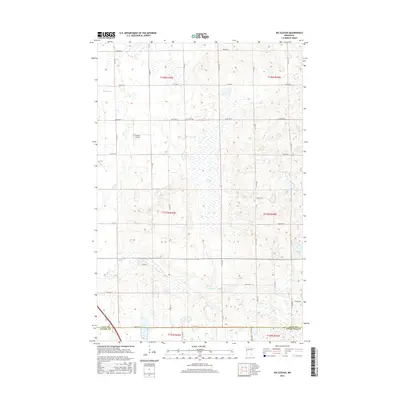
2016 Map of Big Slough
USGS Topo · Published 2016About this map
Big Slough dominates the central wetlands of this landscape, carving a wide path through the prairie of south-central Clay County. The terrain is defined by a series of north-south running streams, including Spring Cr and Stony Cr in the west, while Whisky Cr meanders across the southern plains. The agricultural grid is firmly established, punctuated by local landmarks like the Gran Cem near the center of the survey area and Janssen Airport to the northwest. Near the eastern boundary, the waters of Solem Lake provide a rare stationary pool amidst the drainage network. This area highlights the transition into the flat Red River Valley, where the natural hydrology of sloughs and creeks dictated the placement of section lines and the county boundaries shared with Wilkin and Otter Tail counties.
Find a feature on this map
32 named features on this map. Tap any name to fly to it.
Don’t see what you’re looking for? This feature index may not catch every label — zoom into the map to look around manually.
Map Details
Editions of this 2016 Big Slough Map
This is the sole edition of this map. No revisions or reprints were ever made.
Other maps of this area

1914 · Pelican Rapids
USGS Topo · 1:62,500

1917 · Pelican Rapids
USGS Topo · 1:62,500

1919 · Barnesville
USGS Topo · 1:62,500

1919 · Hawley
USGS Topo · 1:62,500

1952 · Barnesville
USGS Topo · 1:62,500

1953 · Fargo
USGS Topo · 1:250,000

1956 · Fargo
USGS Topo · 1:250,000
1966 · Hawley SE
USGS Topo · 1:24,000
1966 · Downer
USGS Topo · 1:24,000
1966 · Lake Park SW
USGS Topo · 1:24,000