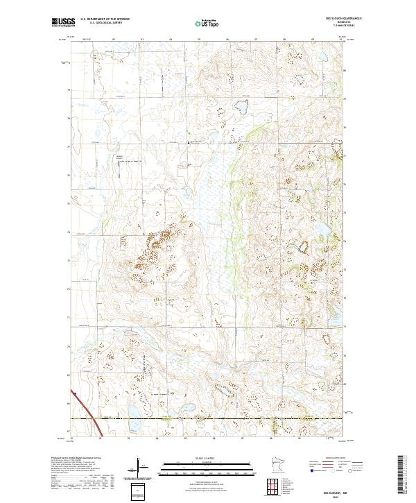
2022 Map of Big Slough
USGS Topo · Published 2022About this map
Gran Lutheran Church Cem sits as a central cultural landmark in this rural landscape where Clay, Wilkin, and Otter Tail counties meet. The terrain is defined by a complex network of prairie drainage, notably the namesake Big Slough and several meandering waterways including Whisky Cr and Spring Cr. This contemporary topographic survey shows how the land remains primarily divided by a strict grid of gravel and paved roads, such as 100th Ave S and 180th Ave S, which follow the section lines of the Public Land Survey System. Aviation history in the area is represented by the Janssen Airport, while Solem Lake provides a natural anchor in the southeastern corner of the quadrangle. The map captures the persistent agrarian character of the Red River Valley borderlands.
Find a feature on this map
30 named features on this map. Tap any name to fly to it.
Don’t see what you’re looking for? This feature index may not catch every label — zoom into the map to look around manually.
Map Details
Editions of this 2022 Big Slough Map
This is the sole edition of this map. No revisions or reprints were ever made.
Other maps of this area

1914 · Pelican Rapids
USGS Topo · 1:62,500

1917 · Pelican Rapids
USGS Topo · 1:62,500

1919 · Barnesville
USGS Topo · 1:62,500

1919 · Hawley
USGS Topo · 1:62,500

1952 · Barnesville
USGS Topo · 1:62,500

1953 · Fargo
USGS Topo · 1:250,000

1956 · Fargo
USGS Topo · 1:250,000
1966 · Hawley SE
USGS Topo · 1:24,000
1966 · Downer
USGS Topo · 1:24,000
1966 · Lake Park SW
USGS Topo · 1:24,000