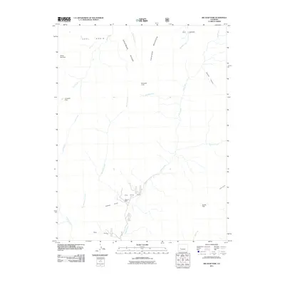
2011 Map of Big Soap Park
USGS Topo · Published 2011About this map
Big Soap Park and the nearby Waterman Ranch serve as the primary human identifiers in this high-altitude landscape within Gunnison County. The terrain is defined by a series of prominent peaks and ridgelines, including Kaufman Ridge and Haystack Mountain, which separate various drainage basins. The map captures a complex network of seasonal and perennial waterways that feed into the larger watershed, such as Soap Creek, Kaufman Creek, and the multiple forks of Curecanti Creek.
Find a feature on this map
24 named features on this map. Tap any name to fly to it.
Don’t see what you’re looking for? This feature index may not catch every label — zoom into the map to look around manually.
Map Details
Editions of this 2011 Big Soap Park Map
This is the sole edition of this map. No revisions or reprints were ever made.
Other maps of this area

1888 · Anthracite
USGS Topo · 1:62,500

1889 · Anthracite
USGS Topo · 1:62,500

1893 · Anthracite
USGS Topo · 1:62,500

1894 · Anthracite
USGS Topo · 1:62,500

1938 · Mt. Gunnison
USGS Topo · 1:48,000

1945 · Mount Gunnison
USGS Topo · 1:62,500

1954 · West Elk Peak SW
USGS Topo · 1:24,000

1954 · Little Soap Park
USGS Topo · 1:24,000

1956 · Montrose
USGS Topo · 1:250,000

1957 · X Lazy F Ranch
USGS Topo · 1:24,000