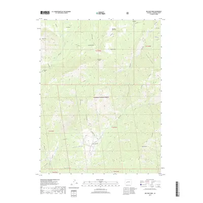
2019 Map of Big Soap Park
USGS Topo · Published 2019About this map
Gunnison National Forest dominates this high-altitude landscape in the West Elk Mountains, where the drainage patterns of Soap Creek and Curecanti divide the terrain. The central namesake meadow, Big Soap Park, sits at the convergence of several major creek systems, including Coffeepot Creek and Kaufman Cr. The map reveals a complex vertical geography of ridges and basins, such as Kaufman Ridge and the broad Coal Basin to the north. Distinctive landmarks like Porcupine Cone and Bonfisk Peak serve as primary navigational anchors for the area. The prevalence of named gulches and basins, including Jackass Gulch and Elk Basin, points to a long history of seasonal grazing and wildlife movement through this part of Gunnison County. Access is marked by the rugged Trail Creek and the high-elevation crossing at Curecanti Pass.
Find a feature on this map
40 named features on this map. Tap any name to fly to it.
Don’t see what you’re looking for? This feature index may not catch every label — zoom into the map to look around manually.
Map Details
Editions of this 2019 Big Soap Park Map
This is the sole edition of this map. No revisions or reprints were ever made.
Other maps of this area

1888 · Anthracite
USGS Topo · 1:62,500

1889 · Anthracite
USGS Topo · 1:62,500

1893 · Anthracite
USGS Topo · 1:62,500

1894 · Anthracite
USGS Topo · 1:62,500

1938 · Mt. Gunnison
USGS Topo · 1:48,000

1945 · Mount Gunnison
USGS Topo · 1:62,500

1954 · West Elk Peak SW
USGS Topo · 1:24,000

1954 · Little Soap Park
USGS Topo · 1:24,000

1956 · Montrose
USGS Topo · 1:250,000

1957 · X Lazy F Ranch
USGS Topo · 1:24,000