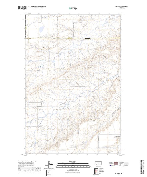
2024 Map of Big Spring
USGS Topo · Published 2024About this map
Indian Buttes rise above the drainage systems of Central Montana along the border of Fergus and Judith Basin counties. This landscape is defined by its series of intermittent watercourses, including Dry Wolf Creek, Sage Creek, and the eponymous Big Spring. The terrain is deeply etched by Big Sagebrush Coulee, reflecting the high-plains geography where water management and road networks follow the natural contours of the benches and coulees.
Find a feature on this map
27 named features on this map. Tap any name to fly to it.
Don’t see what you’re looking for? This feature index may not catch every label — zoom into the map to look around manually.
Map Details
Editions of this 2024 Big Spring Map
This is the sole edition of this map. No revisions or reprints were ever made.
Other maps of this area

1890 · Fort Benton
USGS Topo · 1:250,000

1892 · Fort Benton
USGS Topo · 1:250,000

1897 · Fort Benton
USGS Topo · 1:250,000

1954 · Great Falls
USGS Topo · 1:250,000

1954 · Lewistown
USGS Topo · 1:250,000

1957 · Great Falls
USGS Topo · 1:250,000

1959 · Lewistown
USGS Topo · 1:250,000

1970 · Harwood Bench
USGS Topo · 1:24,000
1970 · Moccasin
USGS Topo · 1:24,000
1970 · Kolin
USGS Topo · 1:24,000