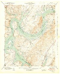
1943 Map of Big Spring
USGS Topo · Published 1946About this map
Chickamauga Reservoir dominates this 1940s landscape, reflecting the massive transformation of the Tennessee River valley during the early TVA era. The waters surround the large Hiwassee Island and back into numerous tributaries like Richland Creek and Mud Creek. This period shows the transition from river-dependent commerce to a managed waterway, evidenced by the Cotton Port Ferry crossing still in operation near the Malaria Control Base.
Find a feature on this map
57 named features on this map. Tap any name to fly to it.
Don’t see what you’re looking for? This feature index may not catch every label — zoom into the map to look around manually.
Map Details
Editions of this 1943 Big Spring Map
2 editions found
Other maps of this area

1886 · Cleveland
USGS Topo · 1:125,000

1887 · Kingston
USGS Topo · 1:125,000

1888 · Chattanooga
USGS Topo · 1:125,000

1891 · Kingston
USGS Topo · 1:125,000

1892 · Pikeville
USGS Topo · 1:125,000

1892 · Cleveland
USGS Topo · 1:125,000

1893 · Chattanooga
USGS Topo · 1:125,000

1893 · Kingston
USGS Topo · 1:125,000

1895 · Cleveland
USGS Topo · 1:125,000

1895 · Pikeville
USGS Topo · 1:125,000