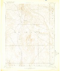
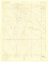
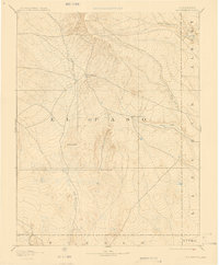
1893 Map of Big Springs
USGS Topo · Published 1922About this map
Big Springs and the surrounding high plains of El Paso County are depicted here as they appeared in the late nineteenth century. Surveyed by Willard D. Johnson in 1889, this reconnaissance sheet captures a landscape defined by intermittent watercourses and isolated ranching outposts. The network of drainage systems, including the prominent Black Squirrel Creek and Horse Creek, suggests the vital importance of water rights in this semi-arid region.
Find a feature on this map
15 named features on this map. Tap any name to fly to it.
Don’t see what you’re looking for? This feature index may not catch every label — zoom into the map to look around manually.
Map Details
Editions of this 1893 Big Springs Map
5 editions found

Other maps of this area

1889 · Sanborn
USGS Topo · 1:125,000

1891 · Sanborn
USGS Topo · 1:125,000

1891 · Catlin
USGS Topo · 1:125,000

1891 · Pueblo
USGS Topo · 1:125,000

1891 · Nepesta
USGS Topo · 1:125,000

1891 · Limon
USGS Topo · 1:125,000

1892 · Limon
USGS Topo · 1:125,000

1893 · Nepesta
USGS Topo · 1:125,000

1893 · Sanborn
USGS Topo · 1:125,000

1893 · Big Springs
USGS Topo · 1:125,000