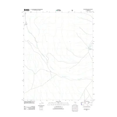
2012 Map of Big Springs
USGS Topo · Published 2012About this map
Big Springs and the nearby Big Springs Ranch define the human footprint in this corner of White Pine County, where water is the primary driver of the landscape. The drainage of Big Spring Wash meanders across the territory, tracing a path through the arid terrain alongside Big Springs Creek. The high-desert geography is further marked by the deep cut of West Fork Canyon to the west. This 2012 survey illustrates the sparse but critical transportation network serving this remote ranching area, including Co Rd 44 and NFD 890 Rd. The map provides a clear look at how topography and limited water sources dictacted settlement patterns and road placement in the Great Basin at the start of the twenty-first century.
Find a feature on this map
7 named features on this map. Tap any name to fly to it.
Don’t see what you’re looking for? This feature index may not catch every label — zoom into the map to look around manually.
Map Details
Editions of this 2012 Big Springs Map
This is the sole edition of this map. No revisions or reprints were ever made.
Other maps of this area

1948 · Wheeler Peak
USGS Topo · 1:62,500

1949 · Garrison
USGS Topo · 1:62,500

1950 · Wheeler Peak
USGS Topo · 1:62,500

1951 · Garrison
USGS Topo · 1:62,500

1956 · Lund
USGS Topo · 1:250,000

1960 · Lund
USGS Topo · 1:250,000

1972 · Miller Wash
USGS Topo · 1:24,000

1972 · Hyde Well
USGS Topo · 1:24,000
1972 · Tweedy Wash
USGS Topo · 1:24,000

1972 · Big Springs
USGS Topo · 1:24,000