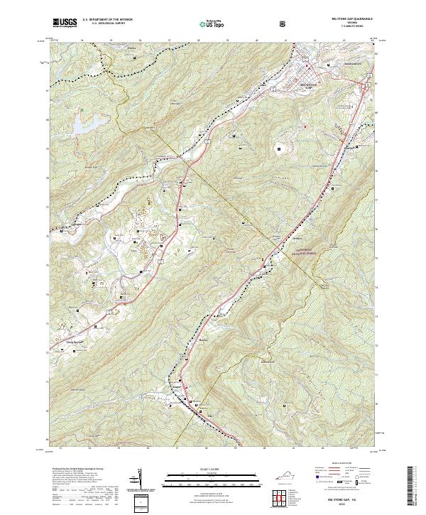
2022 Map of Big Stone Gap
USGS Topo · Published 2022About this map
Big Stone Gap sits at the confluence of the South Fork Powell River and Pigeon Cr, serving as a central hub for this portion of Wise County. The landscape is defined by the heavy presence of coal-country heritage, reflected in numerous family cemeteries like Robinette Cem, Wampler Cem, and Bishop Cem that dot the valleys of Lovelady Valley and Williams Cove. The map documents the modern footprint of Mountain Empire Community College alongside older landmarks like Seminary Church. Beyond the residential centers of Jasper, Olinger, and Exeter, the terrain rises into the Jefferson National Forest, where the Stone Mountain Trl and Wallen Ridge Trl follow the high ridges. This survey provides a clear view of the relationship between the river-bottom settlements and the surrounding mountain passes such as Turkey Cove Gap.
Find a feature on this map
104 named features on this map. Tap any name to fly to it.
Don’t see what you’re looking for? This feature index may not catch every label — zoom into the map to look around manually.
Map Details
Editions of this 2022 Big Stone Gap Map
This is the sole edition of this map. No revisions or reprints were ever made.
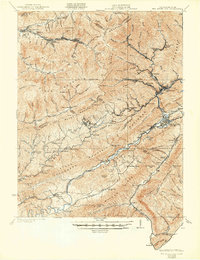
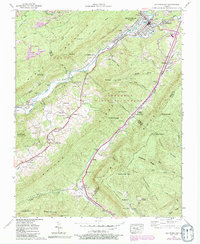
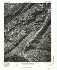
Historical Maps of Jasper Through Time
6 maps found