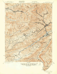
1929 Map of Big Stone Gap
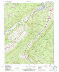
USGS Topo · Published 1950About this map
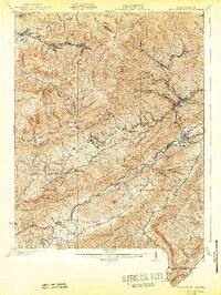
The coal and timber country of Wise and Lee Counties comes to life in this survey, where narrow valleys dictate the paths of industry and settlement. Industrial outposts like Stonega, Lynch, and Benham are tied together by a complex network of the Southern RR, Interstate RR, and L & N RR, which snake through the gaps of Black Mountain and Stone Mountain. In the south, the landscape transitions toward the broader Powell River valley, where agricultural and community markers such as Johnsons Mill Post Office, Robbins Chapel, and the De Busk Ford provide vital reference points for genealogists. The topography reveals the sheer density of small mining camps and rail junctions that characterized the region before the consolidation of mid-century industry, with schools like Deep Spring School and Green Hill School serving these mountain hollows.
Find a feature on this map
130 named features on this map. Tap any name to fly to it.
Don’t see what you’re looking for? This feature index may not catch every label — zoom into the map to look around manually.
Map Details
Editions of this 1929 Big Stone Gap Map
3 editions found

Historical Maps of Big Stone Gap Through Time
6 maps found