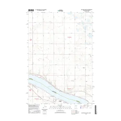
2016 Map of Big Stone Lake East
USGS Topo · Published 2016About this map
Big Stone Lake forms a natural border between Minnesota and South Dakota in this 2016 survey, where the water's edge defines much of the local activity. The southern shore in Roberts County is dotted with distinct landings and points, including Schmidt Landing and Point Comfort, connected by a network of local routes like S Dakota Highway 109 and Woodshore Dr. These shoreline developments reflect the area's long-standing draw for local residence and recreation.
Find a feature on this map
51 named features on this map. Tap any name to fly to it.
Don’t see what you’re looking for? This feature index may not catch every label — zoom into the map to look around manually.
Map Details
Editions of this 2016 Big Stone Lake East Map
This is the sole edition of this map. No revisions or reprints were ever made.
Other maps of this area

1916 · Beardsley
USGS Topo · 1:62,500

1918 · Beardsley
USGS Topo · 1:62,500

1950 · Graceville
USGS Topo · 1:62,500

1953 · Ortonville
USGS Topo · 1:62,500

1953 · Milbank
USGS Topo · 1:250,000

1954 · Big Stone Lake
USGS Topo · 1:62,500

1958 · Milbank
USGS Topo · 1:250,000

1971 · Big Stone Lake East
USGS Topo · 1:24,000

1971 · Big Stone Lake West
USGS Topo · 1:24,000

1971 · Big Stone Lake SE
USGS Topo · 1:24,000