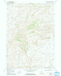
1968 Map of Big Sulfur Draw
USGS Topo · Published 1991About this map
Big Sulfur Spring and the drainage of Big Sulfur Draw dominate this central Natrona County landscape as it appeared in the late 1960s. The terrain is defined by a network of intermittent watercourses and small ranching improvements, including the uniquely named Suicide Bed Grounds Res and Alkali Res. This arid environment relied heavily on managed water sources, evidenced by the Lower Hackett Cr Reservoir and various Flowing Wells located near Alkali Creek. The northern reaches are accessed via Thirtythree Mile Road, while the southern portion of the quadrangle touches the Powder River and Indian Creek. This survey captures the specialized infrastructure of the Wyoming high plains, from isolated drill holes to the complex topographical folds of Stone and Timber Draw.
Find a feature on this map
19 named features on this map. Tap any name to fly to it.
Don’t see what you’re looking for? This feature index may not catch every label — zoom into the map to look around manually.
Map Details
Editions of this 1968 Big Sulfur Draw Map
2 editions found
Other maps of this area

1955 · Arminto
USGS Topo · 1:250,000

1958 · Arminto
USGS Topo · 1:250,000

1962 · Arminto
USGS Topo · 1:250,000

1968 · Willow Creek School
USGS Topo · 1:24,000

1968 · Roughlock Hill
USGS Topo · 1:24,000

1968 · Reynolds Reservoir
USGS Topo · 1:24,000

1968 · Big Sulfur Draw
USGS Topo · 1:24,000

1968 · Fiftymile Flat
USGS Topo · 1:24,000
1968 · Anderson Draw
USGS Topo · 1:24,000

1968 · Flat Top Hill
USGS Topo · 1:24,000