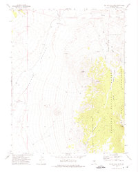
1971 Map of Big Ten Peak West
USGS Topo · Published 1975About this map
The high desert landscape of Ralston Valley meets the rising slopes of the Monitor Mountains in this early 1970s survey. This arid terrain is defined by its critical water points and remote landmarks, including the Spanish Pipeline Well and Trudgen Well. To the east, the boundary of the Toiyabe National Forest encompasses prominent summits like Hat Peak and Big Ten Peak, where the topography becomes increasingly complex with deep cuts like Mine Canyon.
Find a feature on this map
26 named features on this map. Tap any name to fly to it.
Don’t see what you’re looking for? This feature index may not catch every label — zoom into the map to look around manually.
Map Details
Editions of this 1971 Big Ten Peak West Map
This is the sole edition of this map. No revisions or reprints were ever made.
Other maps of this area

1907 · Tonopah
USGS Topo · 1:250,000

1908 · Tonopah
USGS Topo · 1:250,000

1956 · Tonopah
USGS Topo · 1:250,000

1959 · Tonopah
USGS Topo · 1:250,000

1962 · Tonopah
USGS Topo · 1:250,000

1963 · Baxter Spring
USGS Topo · 1:62,500

1971 · Belmont East
USGS Topo · 1:24,000

1971 · Antelope Spring
USGS Topo · 1:24,000

1971 · Manhattan
USGS Topo · 1:24,000

1971 · Belmont West
USGS Topo · 1:24,000