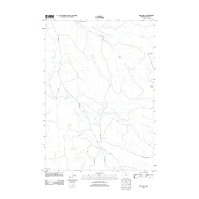
2012 Map of Big Trails
USGS Topo · Published 2012About this map
The Nowood River snakes through the high basins of Washakie County, providing a vital water source for the settlement of Big Trails. This 2012 survey illustrates a landscape defined by ranching and resource management, where the Big Trails Stock Drive Rd and State Land Access routes crisscross the terrain. The presence of the Otter Creek Ranch Airport underscores the logistical realities of this rural expanse, while the descriptive Need Water Reservoir hints at the historical challenges of water security in the Wyoming interior.
Find a feature on this map
24 named features on this map. Tap any name to fly to it.
Don’t see what you’re looking for? This feature index may not catch every label — zoom into the map to look around manually.
Map Details
Editions of this 2012 Big Trails Map
This is the sole edition of this map. No revisions or reprints were ever made.
Other maps of this area

1955 · Arminto
USGS Topo · 1:250,000

1958 · Arminto
USGS Topo · 1:250,000

1962 · Arminto
USGS Topo · 1:250,000

1966 · Monument Hill
USGS Topo · 1:24,000

1966 · Big Trails
USGS Topo · 1:24,000

1966 · Big Trails NE
USGS Topo · 1:24,000
1966 · Tallon Spring
USGS Topo · 1:24,000

1966 · Indian Creek
USGS Topo · 1:24,000
1966 · Joe Emge Creek
USGS Topo · 1:24,000

1967 · Mahogany Butte
USGS Topo · 1:24,000