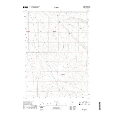
2017 Map of Big Trails
USGS Topo · Published 2017About this map
The Nowood River valley defines this high-plains landscape in southern Washakie County, where the small settlement of Big Trails serves as a remote geographic anchor. Situated at the junction of Big Trails Rd and Upper Nowood Rd, the area is characterized by a complex network of seasonal drainages and deep topographic features like Red Gulch and the distinctive Otter Creek Vee.
Find a feature on this map
26 named features on this map. Tap any name to fly to it.
Don’t see what you’re looking for? This feature index may not catch every label — zoom into the map to look around manually.
Map Details
Editions of this 2017 Big Trails Map
This is the sole edition of this map. No revisions or reprints were ever made.
Other maps of this area

1955 · Arminto
USGS Topo · 1:250,000

1958 · Arminto
USGS Topo · 1:250,000

1962 · Arminto
USGS Topo · 1:250,000

1966 · Monument Hill
USGS Topo · 1:24,000

1966 · Big Trails
USGS Topo · 1:24,000

1966 · Big Trails NE
USGS Topo · 1:24,000
1966 · Tallon Spring
USGS Topo · 1:24,000

1966 · Indian Creek
USGS Topo · 1:24,000
1966 · Joe Emge Creek
USGS Topo · 1:24,000

1967 · Mahogany Butte
USGS Topo · 1:24,000