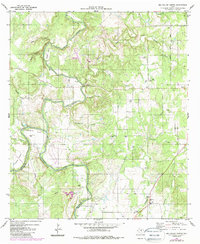
1980 Map of Big Valley North
USGS Topo · Published 1987About this map
The Colorado River winds along the southern edge of this West Central Texas landscape, marking the historic boundary between Mills and San Saba counties. This 1980s revision reveals a sparsely populated ranching region defined by deep drainages and intermittent watercourses like Pecan Bayou and Prescott Creek. The settlement of Big Valley serves as a local anchor, with Big Valley Ch and Big Valley Cem providing significant genealogical points of interest for the surrounding rural community. Evidence of local aviation and transportation is visible at the Smoky Bend Landing Strip and a Roadside Park near the river. The terrain is deeply etched by numerous hollows and bends, including Horseshoe Bend and Grindstone Hollow, reflecting a landscape where geography dictates the placement of isolated homesteads and several small family burial grounds like Catclaw Cem and Estep Cem.
Find a feature on this map
30 named features on this map. Tap any name to fly to it.
Don’t see what you’re looking for? This feature index may not catch every label — zoom into the map to look around manually.
Map Details
Editions of this 1980 Big Valley North Map
2 editions found
Other maps of this area

1885 · San Saba
USGS Topo · 1:125,000

1889 · Brownwood
USGS Topo · 1:125,000

1894 · Brownwood
USGS Topo · 1:125,000

1894 · San Saba
USGS Topo · 1:125,000

1925 · San Saba 2-a
USGS Topo · 1:48,000

1925 · Brownwood 3-d
USGS Topo · 1:48,000

1925 · San Saba 1-c
USGS Topo · 1:48,000

1925 · San Saba 1-b
USGS Topo · 1:48,000

1925 · San Saba 1-d
USGS Topo · 1:48,000

1925 · Brownwood 4-c
USGS Topo · 1:48,000