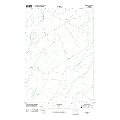
2010 Map of Bigelow
USGS Topo · Published 2010About this map
The Oswegatchie River flows through the northwestern corner of this St. Lawrence County landscape, defining the terrain near the settlement of De Kalb. This region is characterized by a network of rural routes connecting small hamlets and historic crossroads, including East De Kalb, Kents Corners, and Bigelow. Local genealogy is anchored by the East DeKalb Cemetery and West Hermon Cemetery, while the southern reaches are dominated by the waters of Trout Lake and its surrounding tributaries. The landscape is marked by prominent natural features such as Moss Ridge and several meandering waterways, including Indian Creek, Anderson Creek, and Tanner Creek. The road network, featuring names like Old Northerner Rd and Jonesville Rd, reflects the long-standing agricultural and residential patterns of this northern New York community.
Find a feature on this map
41 named features on this map. Tap any name to fly to it.
Don’t see what you’re looking for? This feature index may not catch every label — zoom into the map to look around manually.
Map Details
Editions of this 2010 Bigelow Map
This is the sole edition of this map. No revisions or reprints were ever made.
Other maps of this area

1904 · Ogdensburg
USGS Topo · 1:62,500

1905 · Ogdensburg
USGS Topo · 1:62,500

1910 · Canton
USGS Topo · 1:62,500

1911 · Canton
USGS Topo · 1:62,500

1915 · Gouverneur
USGS Topo · 1:62,500

1915 · Russell
USGS Topo · 1:62,500

1918 · Russell
USGS Topo · 1:62,500

1937 · Gouverneur
USGS Topo · 1:62,500

1943 · Rensselaer Falls
USGS Topo · 1:31,680
1943 · Heuvelton
USGS Topo · 1:31,680