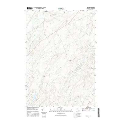
2016 Map of Bigelow
USGS Topo · Published 2016About this map
The Oswegatchie River meanders through the northwestern corner of this Saint Lawrence County landscape, defining a topography of low ridges and winding creek valleys. Small rural settlements like De Kalb, East De Kalb, and Bigelow are connected by a network of county roads that navigate the complex drainage patterns of Indian Creek and Tanner Creek. The terrain is punctuated by significant local landmarks such as Moss Ridge and several historically significant burial grounds, including East DeKalb Cem and West Hermon Cem. This area of Upstate New York maintains a deeply rural character, where the distribution of homesteads and crossroads like Kents Corners reflects a long history of agricultural and timber-based land use shaped by the many tributaries of the Oswegatchie, such as Barter Cr and Brandy Brook.
Find a feature on this map
52 named features on this map. Tap any name to fly to it.
Don’t see what you’re looking for? This feature index may not catch every label — zoom into the map to look around manually.
Map Details
Editions of this 2016 Bigelow Map
This is the sole edition of this map. No revisions or reprints were ever made.
Other maps of this area

1904 · Ogdensburg
USGS Topo · 1:62,500

1905 · Ogdensburg
USGS Topo · 1:62,500

1910 · Canton
USGS Topo · 1:62,500

1911 · Canton
USGS Topo · 1:62,500

1915 · Gouverneur
USGS Topo · 1:62,500

1915 · Russell
USGS Topo · 1:62,500

1918 · Russell
USGS Topo · 1:62,500

1937 · Gouverneur
USGS Topo · 1:62,500

1943 · Rensselaer Falls
USGS Topo · 1:31,680
1943 · Heuvelton
USGS Topo · 1:31,680