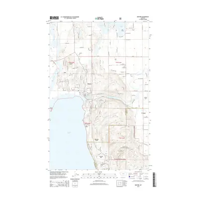
2014 Map of Bigfork
USGS Topo · Published 2014About this map
Bigfork sits at the dramatic confluence of the Swan River and the northeastern shore of Flathead Lake, serving as a central hub for this corner of the Flathead Valley. The landscape is a complex mix of water and timber, with the Swan River Bridge and Bigfork Harbor anchoring the town's waterfront identity. To the north and east, the terrain transitions into a dense network of smaller water bodies including Echo Lake, Peterson Lake, and Johnson Lake. This 2014 survey documents a modern landscape defined by lakeside residential development and recreation, contrasting with the expansive protected wilderness of the Flathead National Forest to the south. Local heritage is preserved in sites like Lonepine Cem and the Bethany Lutheran Cem, while the Ferndale Airfield serves the community of Ferndale on the eastern edge of the quadrangle.
Find a feature on this map
115 named features on this map. Tap any name to fly to it.
Don’t see what you’re looking for? This feature index may not catch every label — zoom into the map to look around manually.
Map Details
Editions of this 2014 Bigfork Map
This is the sole edition of this map. No revisions or reprints were ever made.
Other maps of this area

1914 · Nyack
USGS Topo · 1:125,000

1920 · Flathead Lake
USGS Topo · 1:125,000

1943 · Kalispell
USGS Topo · 1:125,000

1955 · Choteau
USGS Topo · 1:250,000

1956 · Wallace
USGS Topo · 1:250,000

1957 · Choteau
USGS Topo · 1:250,000

1957 · Kalispell
USGS Topo · 1:250,000

1958 · Choteau
USGS Topo · 1:250,000

1960 · Kalispell
USGS Topo · 1:250,000

1960 · Wallace
USGS Topo · 1:250,000