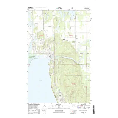
2017 Map of Bigfork
USGS Topo · Published 2017About this map
The Swan River flows through the heart of this region, meeting the massive expanse of Flathead Lake at Bigfork Harbor. This 2017 survey details the complex geography of the shoreline, where the community of Bigfork sits at the river's mouth, and Woods Bay and Long Beach stretch southward along the coast. The transition from the developed Flathead Valley to the protected woodlands of the Flathead National Forest is clearly visible, with the forest boundary climbing the terrain east of Ferndale.
Find a feature on this map
116 named features on this map. Tap any name to fly to it.
Don’t see what you’re looking for? This feature index may not catch every label — zoom into the map to look around manually.
Map Details
Editions of this 2017 Bigfork Map
This is the sole edition of this map. No revisions or reprints were ever made.
Other maps of this area

1914 · Nyack
USGS Topo · 1:125,000

1920 · Flathead Lake
USGS Topo · 1:125,000

1943 · Kalispell
USGS Topo · 1:125,000

1955 · Choteau
USGS Topo · 1:250,000

1956 · Wallace
USGS Topo · 1:250,000

1957 · Choteau
USGS Topo · 1:250,000

1957 · Kalispell
USGS Topo · 1:250,000

1958 · Choteau
USGS Topo · 1:250,000

1960 · Kalispell
USGS Topo · 1:250,000

1960 · Wallace
USGS Topo · 1:250,000