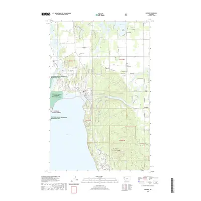
2020 Map of Bigfork
USGS Topo · Published 2020About this map
Flathead Lake dominates the southern landscape of this region, where the Flathead River and Swan River meet the water's edge. The settlement of Bigfork serves as a focal point near the Bigfork Harbor and the historic Swan River Bridge, illustrating a community deeply connected to its aquatic geography. To the east, the landscape transitions into the Flathead National Forest, while the northern reaches are dotted with smaller water bodies like Echo Lake and Peterson Lake.
Find a feature on this map
62 named features on this map. Tap any name to fly to it.
Don’t see what you’re looking for? This feature index may not catch every label — zoom into the map to look around manually.
Map Details
Editions of this 2020 Bigfork Map
This is the sole edition of this map. No revisions or reprints were ever made.
Other maps of this area

1914 · Nyack
USGS Topo · 1:125,000

1920 · Flathead Lake
USGS Topo · 1:125,000

1943 · Kalispell
USGS Topo · 1:125,000

1955 · Choteau
USGS Topo · 1:250,000

1956 · Wallace
USGS Topo · 1:250,000

1957 · Choteau
USGS Topo · 1:250,000

1957 · Kalispell
USGS Topo · 1:250,000

1958 · Choteau
USGS Topo · 1:250,000

1960 · Kalispell
USGS Topo · 1:250,000

1960 · Wallace
USGS Topo · 1:250,000