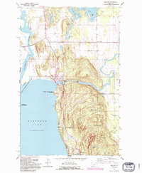
1991 Map of Bigfork
USGS Topo · Published 1995About this map
The confluence of the Swan River and the northeast corner of Flathead Lake defines this mapping of the Bigfork area in the 1990s. The settlement of Bigfork sits at the river's mouth, anchored by the Bigfork Dam and the Bigfork Ranger Station, while the shoreline to the south transitions into the Wayfarers State Park. To the north, the intricate waterways of Echo Lake, Peterson Lake, and the Flathead River reveal a landscape shaped by glacial deposits and river meanders. The map documents the rural development around Ferndale and Woods Bay alongside preserved areas like the Flathead National Forest. This survey captures the region just as modern residential patterns were solidifying around traditional landmarks like Bethany Ch and the small Landing Strip near the river bend.
Find a feature on this map
26 named features on this map. Tap any name to fly to it.
Don’t see what you’re looking for? This feature index may not catch every label — zoom into the map to look around manually.
Map Details
Editions of this 1991 Bigfork Map
This is the sole edition of this map. No revisions or reprints were ever made.
Other maps of this area

1914 · Nyack
USGS Topo · 1:125,000

1920 · Flathead Lake
USGS Topo · 1:125,000

1943 · Kalispell
USGS Topo · 1:125,000

1955 · Choteau
USGS Topo · 1:250,000

1956 · Wallace
USGS Topo · 1:250,000

1957 · Choteau
USGS Topo · 1:250,000

1957 · Kalispell
USGS Topo · 1:250,000

1958 · Choteau
USGS Topo · 1:250,000

1960 · Kalispell
USGS Topo · 1:250,000

1960 · Wallace
USGS Topo · 1:250,000