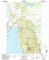
1994 Map of Bigfork
USGS Topo · Published 1996About this map
Bigfork stands as the primary hub where the Swan River meets the expansive waters of Flathead Lake. This mid-1990s survey by the Forest Service and Geological Survey details a landscape defined by the confluence of major waterways and the managed wildlands of the Flathead National Forest. Significant local institutions are documented, including the Bigfork Post Office, the Bigfork Ranger Station, and regional churches like Little Brown Ch and Bethany Ch.
Find a feature on this map
34 named features on this map. Tap any name to fly to it.
Don’t see what you’re looking for? This feature index may not catch every label — zoom into the map to look around manually.
Map Details
Editions of this 1994 Bigfork Map
This is the sole edition of this map. No revisions or reprints were ever made.
Other maps of this area

1914 · Nyack
USGS Topo · 1:125,000

1920 · Flathead Lake
USGS Topo · 1:125,000

1943 · Kalispell
USGS Topo · 1:125,000

1955 · Choteau
USGS Topo · 1:250,000

1956 · Wallace
USGS Topo · 1:250,000

1957 · Choteau
USGS Topo · 1:250,000

1957 · Kalispell
USGS Topo · 1:250,000

1958 · Choteau
USGS Topo · 1:250,000

1960 · Kalispell
USGS Topo · 1:250,000

1960 · Wallace
USGS Topo · 1:250,000