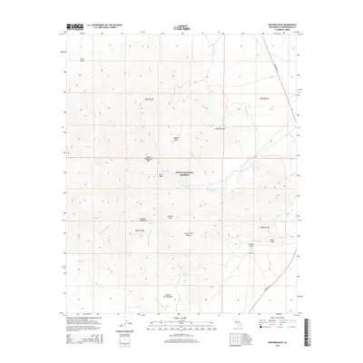
2015 Map of Bighorn Basin
USGS Topo · Published 2015About this map
Mojave National Preserve encompasses most of this landscape, where the high desert terrain of the Mojave Desert meets the dramatic rises of the Granite Mountains. The topography is defined by significant elevation changes, from the alluvial fans of Devils Playground Wash to the heights of Silver Peak and Granite Peak. A network of ephemeral drainages and named water sources reveals the vital hydrology of the region, including Budweiser Spring, Coyote Springs, and Willow Spring.
Find a feature on this map
29 named features on this map. Tap any name to fly to it.
Don’t see what you’re looking for? This feature index may not catch every label — zoom into the map to look around manually.
Map Details
Editions of this 2015 Bighorn Basin Map
This is the sole edition of this map. No revisions or reprints were ever made.
Other maps of this area

1942 · Amboy
USGS Topo · 1:250,000

1943 · Amboy
USGS Topo · 1:250,000

1954 · Needles
USGS Topo · 1:250,000

1956 · Needles
USGS Topo · 1:250,000

1956 · Cadiz
USGS Topo · 1:62,500
1956 · Bagdad
USGS Topo · 1:62,500

1956 · Flynn
USGS Topo · 1:62,500
1957 · Kerens
USGS Topo · 1:62,500
1960 · Bagdad
USGS Topo · 1:50,000

1981 · Needles
USGS Topo · 1:250,000