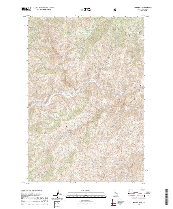
2024 Map of Bighorn Crags
USGS Topo · Published 2024About this map
The Salmon River cuts a deep corridor through this region of Lemhi County, serving as the primary geographical anchor for a landscape defined by dramatic elevation changes. Within the Salmon National Forest, the terrain rises from the riverbanks to the heights of Sagebrush Mtn and the prominent Bighorn Crags. This 2024 survey details a network of primitive access points including the Salmon River Rd and the Panther Creek Rd, which parallel the major watercourses. Historically significant sites such as Owl Hot Springs and the expansive Poverty Flat are documented alongside numerous drainages like Dutch Oven Creek and Rancherio Creek. The map also delineates the boundaries of the Frank Church-River of No Return Wilderness, emphasizing the preservation of this backcountry environment where footpaths like the Owl Creek Trl and Bighorn Crags Trl provide the only passage.
Find a feature on this map
50 named features on this map. Tap any name to fly to it.
Don’t see what you’re looking for? This feature index may not catch every label — zoom into the map to look around manually.
Map Details
Editions of this 2024 Bighorn Crags Map
This is the sole edition of this map. No revisions or reprints were ever made.
Other maps of this area

1950 · Blackbird Mtn
USGS Topo · 1:62,500

1951 · Blackbird Mtn
USGS Topo · 1:62,500

1956 · Elk City
USGS Topo · 1:250,000

1960 · Elk City
USGS Topo · 1:250,000

1960 · Shoup
USGS Topo · 1:62,500

1962 · Long Tom Mtn
USGS Topo · 1:24,000

1962 · Mt Mc Guire
USGS Topo · 1:24,000

1962 · Horse Creek Butte
USGS Topo · 1:24,000

1982 · Bighorn Crags
USGS Topo · 1:100,000
1989 · Gant Ridge
USGS Topo · 1:24,000