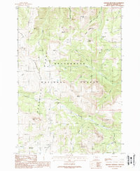
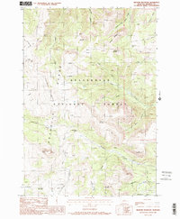
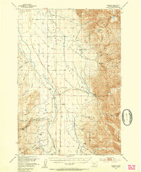
1988 Map of Bighorn Mountain
USGS Topo · Published 1988About this map
The Gravelly Range dominates this portion of Madison County, providing a high-elevation landscape defined by the drainage systems of the Ruby River and South Fork Standard Creek. This 1988 provisional edition captures a region primarily dedicated to forest management and seasonal ranching within the Beaverhead National Forest. Notable human imprints include the Relish Sheep Headquarters at the southern edge and the Black Butte Cabin situated near the base of the prominent Black Butte. The presence of Adit and Prospects labels near Wolverine Basin indicates the area's history of mineral exploration. High-country water features like Kelly Reservoir and Wall Creek Lake are connected by a network of unimproved routes, including the Gravelly Range Road, which serves as a primary artery through these summits.
Find a feature on this map
43 named features on this map. Tap any name to fly to it.
Don’t see what you’re looking for? This feature index may not catch every label — zoom into the map to look around manually.
Map Details
Editions of this 1988 Bighorn Mountain Map
2 editions found
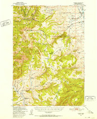
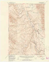
Other maps of this area

1888 · Three Forks
USGS Topo · 1:250,000

1894 · Three Forks
USGS Topo · 1:250,000

1895 · Three Forks
USGS Topo · 1:250,000

1947 · Bozeman
USGS Topo · 1:250,000

1948 · Bozeman
USGS Topo · 1:250,000
1949 · Varney
USGS Topo · 1:62,500
1950 · Cliff Lake
USGS Topo · 1:62,500
1950 · Cameron
USGS Topo · 1:62,500
1950 · Monument Ridge
USGS Topo · 1:62,500

1955 · Bozeman
USGS Topo · 1:250,000