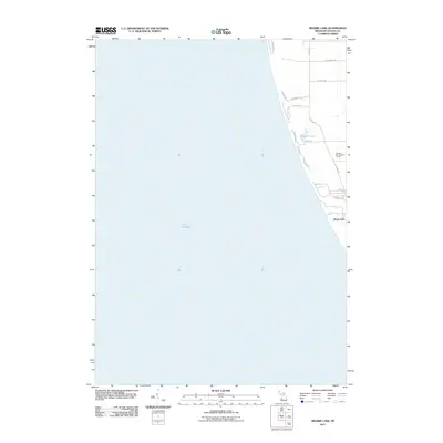
2011 Map of Bigsbie Lake
USGS Topo · Published 2011About this map
Lake Michigan dominates the western half of this coastal survey, where the waters meet the shoreline of Oceana County. The settlement of Stony Lake is situated at the southern end of the landmass, serving as a focal point for the residential and recreational landscape. Inland, Bigsbie Lake is surrounded by a network of local roads including W Grant Rd and Lakeview Dr. The terrain exhibits a mix of wooded areas and cleared land, notably featuring the Benona Shores Golf Course near the eastern boundary. The road system, defined by routes like Scenic Dr and S Bluff Rd, reflects the area's development as a lakeshore community organized around its natural water features and shoreline access.
Find a feature on this map
17 named features on this map. Tap any name to fly to it.
Don’t see what you’re looking for? This feature index may not catch every label — zoom into the map to look around manually.
Map Details
Editions of this 2011 Bigsbie Lake Map
This is the sole edition of this map. No revisions or reprints were ever made.
Other maps of this area

1929 · Montague
USGS Topo · 1:48,000

1931 · Hart NW
USGS Topo · 1:31,680

1954 · Milwaukee
USGS Topo · 1:250,000

1958 · Milwaukee
USGS Topo · 1:250,000

1959 · Montague
USGS Topo · 1:62,500

1959 · Hart
USGS Topo · 1:62,500

1976 · Montague NW
USGS Topo · 1:24,000
1976 · Hart NW
USGS Topo · 1:24,000
1982 · Muskegon
USGS Topo · 1:100,000
1983 · Mears
USGS Topo · 1:25,000