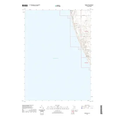
2019 Map of Bigsbie Lake
USGS Topo · Published 2019About this map
Lake Michigan dominates the western half of this coastal survey, where the shoreline of Oceana County meets the freshwater sea at Little Sable Point. The landscape is defined by the interaction of shifting dunes and inland waters, with the namesake Bigsbie Lake tucked behind the coastal ridge. Further south, the community at Stony Lake serves as a focal point for local settlement, situated where the inland lake nearly meets the Great Lake shore. A network of local roads including Peaceful Valley Rd, Sable Point Dr, and Ottawattamie Trl provides access to these waterfront properties and seasonal retreats. The map illustrates the specialized geography of the Michigan fruit belt and resort country, characterized by narrow paved ways and distinctive residential clusters along the bluff tops.
Find a feature on this map
24 named features on this map. Tap any name to fly to it.
Don’t see what you’re looking for? This feature index may not catch every label — zoom into the map to look around manually.
Map Details
Editions of this 2019 Bigsbie Lake Map
This is the sole edition of this map. No revisions or reprints were ever made.
Other maps of this area

1929 · Montague
USGS Topo · 1:48,000

1931 · Hart NW
USGS Topo · 1:31,680

1954 · Milwaukee
USGS Topo · 1:250,000

1958 · Milwaukee
USGS Topo · 1:250,000

1959 · Montague
USGS Topo · 1:62,500

1959 · Hart
USGS Topo · 1:62,500

1976 · Montague NW
USGS Topo · 1:24,000
1976 · Hart NW
USGS Topo · 1:24,000
1982 · Muskegon
USGS Topo · 1:100,000
1983 · Mears
USGS Topo · 1:25,000