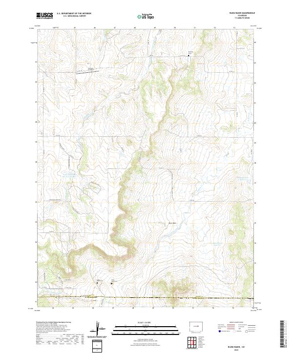
2022 Map of Bijou Basin
USGS Topo · Published 2022About this map
The high plains of Elbert County meet the southern drainage of the Platte River system in this topographic study. The Bijou Basin dominates the central landscape, a broad valley carved by the seasonal flows of West Bijou Creek and its tributaries like W Bijou Cr. The area reflects a sparse, ranching-oriented settlement pattern typical of the Colorado plains, punctuated by isolated landmarks such as Red Cloud Ridge. Local history is anchored by small, private burial sites including the Roehling Grave and the Silva Ranch Cem, alongside the Bijou Basin Cem. Water management is central to life here, evidenced by several catchments like the Triple L Detention Reservoir Number 1 and Max Killian Reservoir. Near the northern boundary, the Flying G Air Ranch indicates the modern integration of aviation into this traditional rangeland.
Find a feature on this map
82 named features on this map. Tap any name to fly to it.
Don’t see what you’re looking for? This feature index may not catch every label — zoom into the map to look around manually.
Map Details
Editions of this 2022 Bijou Basin Map
This is the sole edition of this map. No revisions or reprints were ever made.
Other maps of this area

1894 · Castle Rock
USGS Topo · 1:125,000

1913 · Castle Rock
USGS Topo · 1:125,000

1939 · Elizabeth
USGS Topo · 1:62,500

1940 · Elbert
USGS Topo · 1:62,500

1944 · Elbert
USGS Topo · 1:62,500

1945 · Elizabeth
USGS Topo · 1:62,500

1953 · Denver
USGS Topo · 1:250,000
1954 · Eastonville
USGS Topo · 1:24,000

1957 · Denver
USGS Topo · 1:250,000

1958 · Denver
USGS Topo · 1:250,000