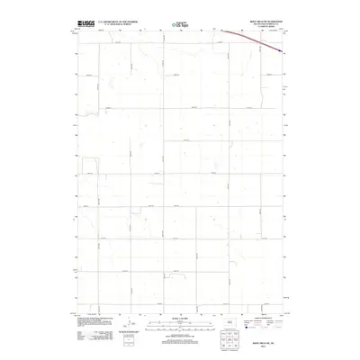
2012 Map of Bijou Hills NE
USGS Topo · Published 2012About this map
Smith Township and the surrounding Brule County landscape are defined by a strict section-line road network that governs the agricultural distribution of this South Dakota region. This early 21st-century survey reveals a territory organized around long, straight corridors like 356th Ave and 254th St, reflecting the persistent influence of the original Public Land Survey System. The terrain is sparse, with infrequent drainage features and isolated homesteads or farm buildings tucked away from primary routes such as 251st St. Mapping by the U.S. Geological Survey shows a rural environment where transportation is purely functional, connecting remote ranchlands via a grid of avenues and streets like 358th Ave and 259th St.
Find a feature on this map
15 named features on this map. Tap any name to fly to it.
Don’t see what you’re looking for? This feature index may not catch every label — zoom into the map to look around manually.
Map Details
Editions of this 2012 Bijou Hills NE Map
This is the sole edition of this map. No revisions or reprints were ever made.
Other maps of this area

1941 · Pukwana
USGS Topo · 1:62,500

1941 · Kimball North
USGS Topo · 1:62,500

1951 · Pukwana
USGS Topo · 1:62,500

1951 · Kimball North
USGS Topo · 1:62,500

1955 · Mitchell
USGS Topo · 1:250,000

1959 · Mitchell
USGS Topo · 1:250,000

1979 · Bijou Hills NE
USGS Topo · 1:24,000

1979 · Eagle
USGS Topo · 1:24,000
1979 · Red Lake East
USGS Topo · 1:24,000
1979 · Bijou Hills
USGS Topo · 1:24,000