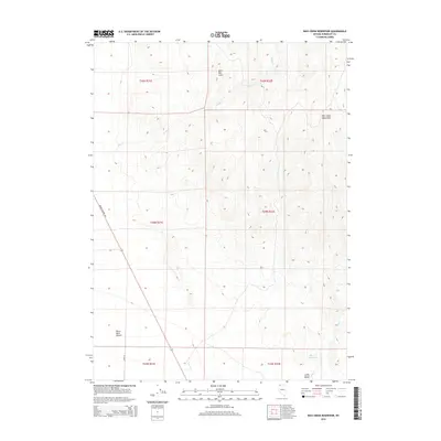
2015 Map of Bilk Creek Reservoir
USGS Topo · Published 2015About this map
Bilk Creek Mountains dominate the eastern horizon of this high-desert landscape in Humboldt County, where the transition from steep slopes to the alluvial floor is clearly defined. In the southeast corner, the terrain softens into Lovely Valley, which is nourished by the waters of Bilk Cr feeding into the Bilk Cr Reservoir. This area represents the northern fringes of the great Black Rock Desert, a land shaped by drainage patterns where seasonal flows like Deep Cr descend from the heights of Split Mtn Cairn. Human presence is marked by the path of Denio Highway 140, a vital transport corridor cutting through the western section of the quadrangle. The map captures a rugged topography where water management and isolated travel routes remain the primary features of the local geography.
Find a feature on this map
15 named features on this map. Tap any name to fly to it.
Don’t see what you’re looking for? This feature index may not catch every label — zoom into the map to look around manually.
Map Details
Editions of this 2015 Bilk Creek Reservoir Map
This is the sole edition of this map. No revisions or reprints were ever made.
Other maps of this area

1886 · Disaster
USGS Topo · 1:250,000

1893 · Disaster
USGS Topo · 1:250,000

1954 · Vya
USGS Topo · 1:250,000

1958 · Vya
USGS Topo · 1:250,000
1961 · Quinn River Crossing
USGS Topo · 1:62,500
1961 · Trident Peak
USGS Topo · 1:62,500

1962 · Vya
USGS Topo · 1:250,000
1965 · Duffer Peak
USGS Topo · 1:62,500
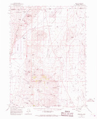
1966 · Denio
USGS Topo · 1:62,500
1979 · Denio
USGS Topo · 1:100,000