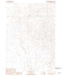
1990 Map of Bilk Creek Reservoir
USGS Topo · Published 1990About this map
The Bilk Creek Mountains dominate this high-desert landscape in Humboldt County, where water management is the primary indicator of human activity. This 1990 provisional survey documents a network of seasonal watercourses and drainage patterns, specifically along Deep Creek and Mud Creek as they descend toward the basin. The presence of several Stock Ponds scattered through the drainages suggests a landscape utilized for livestock grazing, supported by a sparse network of trails and a Private Road that provides access to the interior. Small-scale resource extraction is evident through the inclusion of a Borrow Pit and Gravel Pit, likely used for maintaining local infrastructure. The map centers on the hydrology of Bilk Creek, capturing the topographic character of the region before further modern developments altered these drainage systems.
Find a feature on this map
11 named features on this map. Tap any name to fly to it.
Don’t see what you’re looking for? This feature index may not catch every label — zoom into the map to look around manually.
Map Details
Editions of this 1990 Bilk Creek Reservoir Map
This is the sole edition of this map. No revisions or reprints were ever made.
Other maps of this area

1886 · Disaster
USGS Topo · 1:250,000

1893 · Disaster
USGS Topo · 1:250,000

1954 · Vya
USGS Topo · 1:250,000

1958 · Vya
USGS Topo · 1:250,000

1961 · Quinn River Crossing
USGS Topo · 1:62,500

1961 · Trident Peak
USGS Topo · 1:62,500

1962 · Vya
USGS Topo · 1:250,000

1965 · Duffer Peak
USGS Topo · 1:62,500

1966 · Denio
USGS Topo · 1:62,500

1979 · Denio
USGS Topo · 1:100,000