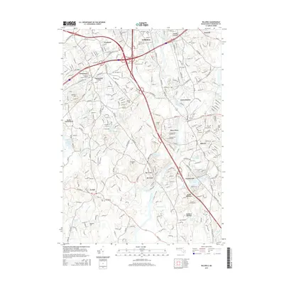
2015 Map of Billerica
USGS Topo · Published 2015About this map
Concord River valley development in the mid-2010s reveals a dense suburban landscape where colonial-era roots intersect with modern infrastructure. In Chelmsford Center, the Forefathers Burying Ground remains a central landmark, while the northern edge of the map in South Lowell is heavily defined by a concentration of burial sites including Saint Patricks Cem and Edson Cem. The Shawsheen River and River-Meadow Brook provide the primary drainage for these historic townships. Modern institutional growth is evident at the Middlesex Community Coll near South Billerica, while the industrial legacy of the region persists at Iron Horse Park in North Billerica. The map also captures numerous smaller residential pockets and water bodies like Nutting Lake and Fawn Lake, reflecting the continued infill of these established Massachusetts communities.
Find a feature on this map
107 named features on this map. Tap any name to fly to it.
Don’t see what you’re looking for? This feature index may not catch every label — zoom into the map to look around manually.
Map Details
Editions of this 2015 Billerica Map
This is the sole edition of this map. No revisions or reprints were ever made.
Other maps of this area

1886 · Lawrence
USGS Topo · 1:62,500

1886 · Lowell
USGS Topo · 1:62,500

1886 · Framingham
USGS Topo · 1:62,500

1888 · Lawrence
USGS Topo · 1:62,500

1889 · Framingham
USGS Topo · 1:62,500

1893 · Lowell
USGS Topo · 1:62,500

1893 · Boston
USGS Topo · 1:62,500

1893 · Lawrence
USGS Topo · 1:62,500

1894 · Framingham
USGS Topo · 1:62,500

1903 · Boston
USGS Topo · 1:62,500