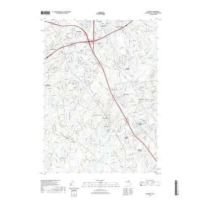
2018 Map of Billerica
USGS Topo · Published 2018About this map
The Concord River carves a winding path through the heart of Middlesex County, anchoring a landscape where suburban growth meets significant ecological preserves. This 2018 survey captures the dense residential neighborhoods of Lowell and Billerica alongside extensive protected wetlands such as Great Meadows and the River Meadow Swamp. The map reveals a high concentration of established burial grounds that serve as touchstones for local genealogy, including the Forefathers Burying Ground Cem in Chelmsford and the sprawling Saint Joseph Cem. The transition from the industrial character of South Lowell to the more open terrain around Nutting Lake and Great Swamp illustrates the region's diverse land use. Detailed labeling of historical thoroughfares like the Old Middlesex Tpke and numerous nature trails, such as the Pepper Grass Trail, provides a clear view of how modern recreation and historical transit routes coexist in this corner of Massachusetts.
Find a feature on this map
58 named features on this map. Tap any name to fly to it.
Don’t see what you’re looking for? This feature index may not catch every label — zoom into the map to look around manually.
Map Details
Editions of this 2018 Billerica Map
This is the sole edition of this map. No revisions or reprints were ever made.
Other maps of this area

1886 · Lawrence
USGS Topo · 1:62,500

1886 · Lowell
USGS Topo · 1:62,500

1886 · Framingham
USGS Topo · 1:62,500

1888 · Lawrence
USGS Topo · 1:62,500

1889 · Framingham
USGS Topo · 1:62,500

1893 · Lowell
USGS Topo · 1:62,500

1893 · Boston
USGS Topo · 1:62,500

1893 · Lawrence
USGS Topo · 1:62,500

1894 · Framingham
USGS Topo · 1:62,500

1903 · Boston
USGS Topo · 1:62,500