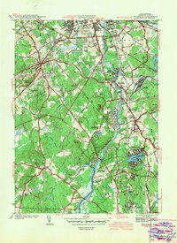
1942 Map of Billerica
USGS Topo · Published 1942About this map
The Concord River meanders northward through this 1942 survey, serving as a central artery between the industrial and residential hubs of Billerica and Chelmsford Center. This landscape, captured just before the height of mid-century suburban expansion, is defined by its institutional and religious infrastructure, including the Maryknoll Seminary, Theresa Convent, and the sprawling U S Veterans Hospital in the southeast.
Find a feature on this map
57 named features on this map. Tap any name to fly to it.
Don’t see what you’re looking for? This feature index may not catch every label — zoom into the map to look around manually.
Map Details
Editions of this 1942 Billerica Map
This is the sole edition of this map. No revisions or reprints were ever made.
Other maps of this area

1886 · Lawrence
USGS Topo · 1:62,500

1886 · Lowell
USGS Topo · 1:62,500

1886 · Framingham
USGS Topo · 1:62,500

1888 · Lawrence
USGS Topo · 1:62,500

1889 · Framingham
USGS Topo · 1:62,500

1893 · Lowell
USGS Topo · 1:62,500

1893 · Boston
USGS Topo · 1:62,500

1893 · Lawrence
USGS Topo · 1:62,500

1894 · Framingham
USGS Topo · 1:62,500

1903 · Boston
USGS Topo · 1:62,500