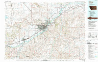
1989 Map of Billings
USGS Topo · Published 1989About this map
Billings serves as the focal point of this late-twentieth-century landscape, positioned where the Yellowstone River and the Burlington Northern railroad corridors converge. The topography is defined by the sharp transition between the river valley and the dramatic Rimrocks, with landmarks like Sacrifice Cliff overlooking the growing urban center. Further south, the map extends into the northern reaches of the Crow Indian Reservation, while the surrounding agricultural plains are dotted with smaller grain-stop settlements including Huntley, Worden, and Ballantine. The map illustrates a period of significant infrastructure, showing the Billings Logan International Airport atop the benchlands and the recreational development at Lake Elmo State Rec Area. To the west, the industrial and transport hub of Laurel is clearly mapped near the confluence of the Clarks Fork Yellowstone River.
Find a feature on this map
65 named features on this map. Tap any name to fly to it.
Don’t see what you’re looking for? This feature index may not catch every label — zoom into the map to look around manually.
Map Details
Editions of this 1989 Billings Map
This is the sole edition of this map. No revisions or reprints were ever made.
Other maps of this area

1889 · Big Snowy Mountain
USGS Topo · 1:250,000

1892 · Stillwater
USGS Topo · 1:125,000

1893 · Big Snowy Mountain
USGS Topo · 1:250,000

1893 · Huntley
USGS Topo · 1:125,000

1894 · St. Xavier
USGS Topo · 1:125,000

1894 · Fort Custer
USGS Topo · 1:125,000

1901 · St. Xavier
USGS Topo · 1:125,000

1915 · Spenceville
USGS Topo · 1:31,680

1932 · Red Lodge No 1
USGS Topo · 1:48,000

1954 · Billings
USGS Topo · 1:250,000