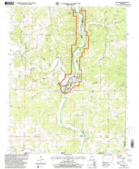
1997 Map of Billmore
USGS Topo · Published 2000About this map
The Eleven Point Wild and Scenic River carves a deep, winding path through the Ozark landscape on this 1997 revision. This corridor, protected within the Mark Twain National Forest, is defined by a dense concentration of hydrological features such as Blue Spring, Morgan Spring, and Vault Spring. The map documents a predominantly rural and forested region where small community centers like Billmore and Calm serve as local anchors.
Find a feature on this map
49 named features on this map. Tap any name to fly to it.
Don’t see what you’re looking for? This feature index may not catch every label — zoom into the map to look around manually.
Map Details
Editions of this 1997 Billmore Map
This is the sole edition of this map. No revisions or reprints were ever made.
Other maps of this area

1941 · Gatewood
USGS Topo · 1:62,500

1944 · Couch
USGS Topo · 1:62,500

1945 · Gatewood
USGS Topo · 1:62,500

1946 · Couch
USGS Topo · 1:62,500

1957 · Poplar Bluff
USGS Topo · 1:250,000

1959 · Poplar Bluff
USGS Topo · 1:250,000

1960 · Poplar Bluff
USGS Topo · 1:250,000
1965 · Riverton
USGS Topo · 1:24,000

1965 · Gatewood
USGS Topo · 1:24,000
1965 · Bardley
USGS Topo · 1:24,000