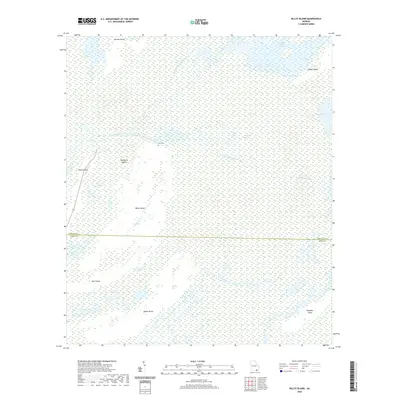
2020 Map of Billys Island
USGS Topo · Published 2020About this map
Billys Island stands as a significant interior upland within the sprawling Okefenokee Swamp, marking a region defined by its isolated hammocks and complex hydrological network. This 2020 survey details the intersection of Ware and Charlton counties, where the Suwannee River begins its course through several distinct branches, including the Middle Fork Suwannee River and East Fork Suwannee River. The map reveals the unique ecological landscape of the swamp, alternating between open waters like Billys Lake and expansive marshy areas such as Chase Prairie and Floyds Island Prairie. Human presence in this environment is represented by the isolated Lee Cem, while the Suwannee Canal serves as a reminder of early attempts to manage and traverse this water-dominated terrain. Distinct landforms like Honey Island and Bugaboo Island provide critical context for understanding the internal geography of one of Georgia's most famous natural landmarks.
Find a feature on this map
23 named features on this map. Tap any name to fly to it.
Don’t see what you’re looking for? This feature index may not catch every label — zoom into the map to look around manually.
Map Details
Editions of this 2020 Billys Island Map
This is the sole edition of this map. No revisions or reprints were ever made.
Other maps of this area

1918 · Folkston
USGS Topo · 1:62,500

1918 · Moniac
USGS Topo · 1:62,500

1942 · Moniac
USGS Topo · 1:62,500

1954 · Valdosta
USGS Topo · 1:250,000

1958 · Valdosta
USGS Topo · 1:250,000

1959 · Valdosta
USGS Topo · 1:250,000

1965 · Chesser Island
USGS Topo · 1:24,000

1965 · Double Lakes
USGS Topo · 1:24,000

1965 · Chase Prairie
USGS Topo · 1:24,000

1965 · Blackjack Island
USGS Topo · 1:24,000