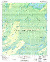
1994 Map of Billys Island
USGS Topo · Published 1994About this map
Billys Island stands as a massive upland sanctuary within the Okefenokee National Wildlife Refuge and Wilderness, showing the complex landscape of the Georgia swamp in the early 1990s. The geography is defined by a network of islands and prairies, including Chase Prairie and Jackson Bay, which rise above the surrounding wetlands. This 1994 map provides a critical look at the remnants of former industrial activity, specifically the extensive network of the Old Railroad Grade that once hauled timber through the interior. These corridors contrast with the managed recreation found at Stephen Foster State Park and the Boat Ramp on Billys Lake. Near the center of the island, the Lee Cem offers a genealogical link to the families who lived and worked in this remote terrain before it was protected federal land. The western boundary is marked by the winding path of the Suwannee River, while the Suwannee Canal cuts through the eastern marshlands.
Find a feature on this map
25 named features on this map. Tap any name to fly to it.
Don’t see what you’re looking for? This feature index may not catch every label — zoom into the map to look around manually.
Map Details
Editions of this 1994 Billys Island Map
2 editions found
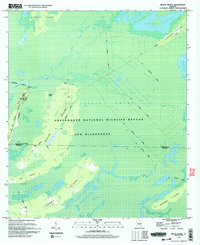
Other maps of this area

1918 · Folkston
USGS Topo · 1:62,500

1918 · Moniac
USGS Topo · 1:62,500

1942 · Moniac
USGS Topo · 1:62,500

1954 · Valdosta
USGS Topo · 1:250,000

1958 · Valdosta
USGS Topo · 1:250,000

1959 · Valdosta
USGS Topo · 1:250,000

1965 · Chesser Island
USGS Topo · 1:24,000

1965 · Double Lakes
USGS Topo · 1:24,000

1965 · Chase Prairie
USGS Topo · 1:24,000

1965 · Blackjack Island
USGS Topo · 1:24,000