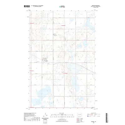
2020 Map of Binford
USGS Topo · Published 2020About this map
Binford serves as the central hub of this Griggs County landscape, where a dense cluster of local streets including W Miller Ave and Whitnery St meet at the town core. The surrounding prairie is defined by a complex glacial topography, resulting in a high density of water bodies ranging from the large Lake Jessie and Lake Addie to smaller basins like Plum Lake and Round Lake. The settlement patterns here are reflected in the preservation of community landmarks, particularly the cemeteries that serve the local population. Genealogists will find the Bethany Cem, Lutheran Cem, and the uniquely named Binford Gospel Tabernacle Cem located north and west of the main townsite. This network of wetlands and small lakes, such as Sibley Lake and Rush Lake, highlights the drainage challenges and environmental character of this section of the Red River Valley upland.
Find a feature on this map
34 named features on this map. Tap any name to fly to it.
Don’t see what you’re looking for? This feature index may not catch every label — zoom into the map to look around manually.
Map Details
Editions of this 2020 Binford Map
This is the sole edition of this map. No revisions or reprints were ever made.
Other maps of this area

1952 · New Rockford
USGS Topo · 1:250,000

1956 · New Rockford
USGS Topo · 1:250,000

1961 · Kloten NW
USGS Topo · 1:24,000

1961 · Binford
USGS Topo · 1:24,000

1961 · Jessie
USGS Topo · 1:24,000

1961 · Sutton
USGS Topo · 1:24,000

1961 · Binford NE
USGS Topo · 1:24,000

1961 · Cooperstown West
USGS Topo · 1:24,000
1961 · Binford NW
USGS Topo · 1:24,000

1961 · Sutton NE
USGS Topo · 1:24,000