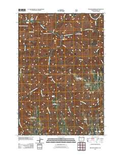
2011 Map of Bingham Springs
USGS Topo · Published 2011About this map
Bingham Springs and the Bar M Ranch anchor the northern reaches of this topographic landscape, where the Umatilla River and its numerous tributaries carve through the mountainous terrain of Umatilla County. The network of waters, including the South Fork Umatilla River and North Fork Umatilla River, defines the area's geography, feeding into a landscape marked by prominent heights such as Grouse Mountain and the uniquely named The Shimmiehorn.
Find a feature on this map
34 named features on this map. Tap any name to fly to it.
Don’t see what you’re looking for? This feature index may not catch every label — zoom into the map to look around manually.
Map Details
Editions of this 2011 Bingham Springs Map
This is the sole edition of this map. No revisions or reprints were ever made.
Other maps of this area

1953 · Pendleton
USGS Topo · 1:250,000

1956 · Pendleton
USGS Topo · 1:250,000

1963 · Andies Prairie
USGS Topo · 1:24,000

1963 · Sanderson Spring
USGS Topo · 1:24,000

1963 · Bingham Springs
USGS Topo · 1:24,000

1963 · Tollgate
USGS Topo · 1:24,000

1963 · Blalock Mountain
USGS Topo · 1:24,000

1964 · Weston Mountain
USGS Topo · 1:24,000

1964 · Duncan
USGS Topo · 1:24,000

1964 · Thimbleberry Mtn
USGS Topo · 1:24,000