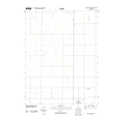
2009 Map of Bird City North
USGS Topo · Published 2009About this map
Bird City serves as the focal point for this Cheyenne County landscape, where the High Plains are etched by drainage patterns and agricultural section lines. The settlement sits at the southern edge of the quadrangle, with the Bird City Cemetery nearby, providing a valuable reference for local family history research. North of the town, the terrain is defined by natural features such as Wolfe Canyon and Sawyer Canyon, which interrupt the vast grid of county roads. The course of Big Timber Creek meanders through the central portion of the map, illustrating the vital role of water resources in this part of Kansas. A network of routes including Co RD 26 and Co RD T underscores the organized development of the region's ranching and farming infrastructure as it stood in the early 21st century.
Find a feature on this map
14 named features on this map. Tap any name to fly to it.
Don’t see what you’re looking for? This feature index may not catch every label — zoom into the map to look around manually.
Map Details
Editions of this 2009 Bird City North Map
This is the sole edition of this map. No revisions or reprints were ever made.
Other maps of this area

1950 · Mc Donald
USGS Topo · 1:62,500

1951 · Bird City North
USGS Topo · 1:62,500

1951 · Mc Donald
USGS Topo · 1:62,500

1951 · Bird City South
USGS Topo · 1:62,500

1951 · Dewey Ranch
USGS Topo · 1:62,500

1954 · Goodland
USGS Topo · 1:250,000

1956 · Goodland
USGS Topo · 1:250,000

1957 · Goodland
USGS Topo · 1:250,000

1976 · Bird City North
USGS Topo · 1:24,000
1976 · Henkle Canyon
USGS Topo · 1:24,000