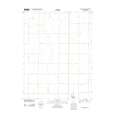
2012 Map of Bird City North
USGS Topo · Published 2012About this map
Bird City anchors the southern edge of this High Plains landscape, where the town's residential grid meets the vast agricultural expanse of Cheyenne County. The survey captures a moment of modern rural organization, defined by a rigid section-line road network including Road V and Co Hwy S that segments the prairie into productive acreage. Cutting across this geometric order is the natural course of Big Timber Cr, which provides the primary topographic variation in an otherwise uniform terrain. Local history and genealogy interests are centered near the southern border, where the Bird City Cem sits just north of the town center. The map details the local infrastructure of the early 21st century, from the primary thoroughfares like Co Rd 29 to the residential streets of Park St and Burr Ave that mark the northern limits of the settlement.
Find a feature on this map
24 named features on this map. Tap any name to fly to it.
Don’t see what you’re looking for? This feature index may not catch every label — zoom into the map to look around manually.
Map Details
Editions of this 2012 Bird City North Map
This is the sole edition of this map. No revisions or reprints were ever made.
Other maps of this area

1950 · Mc Donald
USGS Topo · 1:62,500

1951 · Bird City North
USGS Topo · 1:62,500

1951 · Mc Donald
USGS Topo · 1:62,500

1951 · Bird City South
USGS Topo · 1:62,500

1951 · Dewey Ranch
USGS Topo · 1:62,500

1954 · Goodland
USGS Topo · 1:250,000

1956 · Goodland
USGS Topo · 1:250,000

1957 · Goodland
USGS Topo · 1:250,000

1976 · Bird City North
USGS Topo · 1:24,000
1976 · Henkle Canyon
USGS Topo · 1:24,000