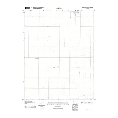
2009 Map of Bird City South
USGS Topo · Published 2009About this map
Bird City sits at the northern edge of this Cheyenne County landscape, where the High Plains transition into a network of drainage ways. The southern reaches are defined by the meandering course of Little Beaver Creek, which carves subtle relief into the agricultural grid. This 2009 survey reveals a rural infrastructure dependent on aviation and organized land management, with both the Bird City Airport and the smaller Gillilands Farm Airport serving the local farming community. The geographic center is marked by the Community Cemetery, a key landmark for genealogical research located along Co RD H. The map illustrates a highly regular system of county roads, such as Co RD 25 and Co RD 30, which partition the territory into large-scale grain production plots characteristic of northwestern Kansas.
Find a feature on this map
21 named features on this map. Tap any name to fly to it.
Don’t see what you’re looking for? This feature index may not catch every label — zoom into the map to look around manually.
Map Details
Editions of this 2009 Bird City South Map
This is the sole edition of this map. No revisions or reprints were ever made.
Other maps of this area

1950 · Mc Donald
USGS Topo · 1:62,500

1951 · Bird City North
USGS Topo · 1:62,500

1951 · Mc Donald
USGS Topo · 1:62,500

1951 · Bird City South
USGS Topo · 1:62,500

1951 · Dewey Ranch
USGS Topo · 1:62,500

1954 · Goodland
USGS Topo · 1:250,000

1956 · Goodland
USGS Topo · 1:250,000

1957 · Goodland
USGS Topo · 1:250,000

1976 · Bird City North
USGS Topo · 1:24,000
1978 · Wheeler
USGS Topo · 1:24,000