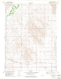
1978 Map of Wheeler
USGS Topo · Published 1978About this map
South Fork Republican River winds through the northwestern corner of this High Plains landscape, cutting a fertile valley through the surrounding tablelands of Cheyenne County. This late-1970s survey captures the small settlement of Wheeler at the junction of regional transport lines, where the Burlington Northern railroad runs parallel to the highway. The land is organized into distinct townships including Orlando, Calhoun, Cleveland, and Bird City, reflecting the systematic agricultural development of western Kansas.
Find a feature on this map
16 named features on this map. Tap any name to fly to it.
Don’t see what you’re looking for? This feature index may not catch every label — zoom into the map to look around manually.
Map Details
Editions of this 1978 Wheeler Map
This is the sole edition of this map. No revisions or reprints were ever made.
Other maps of this area

1942 · St. Francis
USGS Topo · 1:62,500

1943 · St. Francis
USGS Topo · 1:62,500

1951 · St Francis
USGS Topo · 1:62,500

1951 · Bird City North
USGS Topo · 1:62,500

1951 · Bird City South
USGS Topo · 1:62,500

1952 · St Francis 3
USGS Topo · 1:62,500

1954 · Goodland
USGS Topo · 1:250,000

1956 · Goodland
USGS Topo · 1:250,000

1957 · Goodland
USGS Topo · 1:250,000

1976 · Bird City North
USGS Topo · 1:24,000