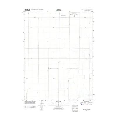
2012 Map of Bird City South
USGS Topo · Published 2012About this map
Bird City occupies the northern edge of this Cheyenne County landscape, where the street grid of S Bird Ave and numbered streets like 5th St transitions abruptly into the vast agricultural township system. This 2012 survey illustrates the high plains economy, anchored by the local Po and the Bressler Field Airport situated just west of the town center. The terrain is defined by a rigid network of section roads, including Road M and Road 27, which carve the prairie into precise squares. To the south, the geometric regularity is broken only by the winding course of Little Beaver Cr and the presence of Greisler Cem, a quiet landmark serving the surrounding farming community. The map provides a clear record of rural land management and the enduring structure of this northwestern Kansas settlement.
Find a feature on this map
25 named features on this map. Tap any name to fly to it.
Don’t see what you’re looking for? This feature index may not catch every label — zoom into the map to look around manually.
Map Details
Editions of this 2012 Bird City South Map
This is the sole edition of this map. No revisions or reprints were ever made.
Other maps of this area

1950 · Mc Donald
USGS Topo · 1:62,500

1951 · Bird City North
USGS Topo · 1:62,500

1951 · Mc Donald
USGS Topo · 1:62,500

1951 · Bird City South
USGS Topo · 1:62,500

1951 · Dewey Ranch
USGS Topo · 1:62,500

1954 · Goodland
USGS Topo · 1:250,000

1956 · Goodland
USGS Topo · 1:250,000

1957 · Goodland
USGS Topo · 1:250,000

1976 · Bird City North
USGS Topo · 1:24,000
1978 · Wheeler
USGS Topo · 1:24,000