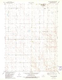
1981 Map of Bird City South
USGS Topo · Published 1981About this map
Bird City sits at the northern edge of this High Plains landscape, serving as a focal point for the surrounding agricultural region in the early 1980s. The town's infrastructure is clearly defined, including the Water Tank, a Beacon, and the Community Landing Field. Outside the town center, the land is marked by an extensive network of wells and agricultural field lines, reflecting the intensive land use of Cheyenne County. To the south, the Gilliland Landing Strip provides another point of aerial access, while the Greisler Cem offers a primary point of interest for genealogists tracing local family history. The southern reaches of the quadrangle are defined by the winding course of Little Beaver Creek, which provides the only major drainage across this otherwise level plateau.
Find a feature on this map
11 named features on this map. Tap any name to fly to it.
Don’t see what you’re looking for? This feature index may not catch every label — zoom into the map to look around manually.
Map Details
Editions of this 1981 Bird City South Map
This is the sole edition of this map. No revisions or reprints were ever made.
Other maps of this area

1950 · Mc Donald
USGS Topo · 1:62,500

1951 · Bird City North
USGS Topo · 1:62,500

1951 · Mc Donald
USGS Topo · 1:62,500

1951 · Bird City South
USGS Topo · 1:62,500

1951 · Dewey Ranch
USGS Topo · 1:62,500

1954 · Goodland
USGS Topo · 1:250,000

1956 · Goodland
USGS Topo · 1:250,000

1957 · Goodland
USGS Topo · 1:250,000

1976 · Bird City North
USGS Topo · 1:24,000
1978 · Wheeler
USGS Topo · 1:24,000