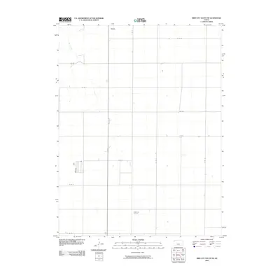
2009 Map of Bird City South NW
USGS Topo · Published 2009About this map
High plains agriculture and isolated rural markers define this corner of Cheyenne County in the early twenty-first century. The landscape is organized by a rigid grid of section-line roads, including Co Rd M and Co Rd E, which facilitate movement between sparse farmsteads and the occasional watercourse like Sand Creek. This drainage system provides one of the few breaks in the geometric regularity of the terrain. For genealogists and local historians, the map serves as a primary record for two burial sites that anchor the area's pioneer heritage: Wheeler Cemetery in the north and Saint Pauls Cemetery to the south. These cemeteries remain as permanent points of reference amidst the vast, shifting seasonal cycles of the Kansas wheat belt, marking the resting places of the families who settled this northwestern reach of the state.
Find a feature on this map
14 named features on this map. Tap any name to fly to it.
Don’t see what you’re looking for? This feature index may not catch every label — zoom into the map to look around manually.
Map Details
Editions of this 2009 Bird City South NW Map
This is the sole edition of this map. No revisions or reprints were ever made.
Other maps of this area

1942 · St. Francis
USGS Topo · 1:62,500

1943 · St. Francis
USGS Topo · 1:62,500

1951 · St Francis
USGS Topo · 1:62,500

1951 · Bird City North
USGS Topo · 1:62,500

1951 · Bird City South
USGS Topo · 1:62,500

1952 · St Francis 3
USGS Topo · 1:62,500

1954 · Goodland
USGS Topo · 1:250,000

1956 · Goodland
USGS Topo · 1:250,000

1957 · Goodland
USGS Topo · 1:250,000

1976 · Bird City North
USGS Topo · 1:24,000