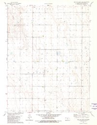
1981 Map of Bird City South NW
USGS Topo · Published 1981About this map
Orlando and Wano townships define this section of the High Plains in Cheyenne County during the early 1980s. The landscape is characterized by a high density of water management features, with numerous Well sites and circular irrigation patterns marking the agricultural development of the region. Local history is anchored by Wheeler Cem in the north and St Pauls Cem to the south, providing clear points of reference for genealogical research. The drainage of Sand Creek cuts across the northwest corner, where industrial activity is noted at the Sandpits. This survey captures a moment when traditional land use in western Kansas intersected with increasing energy and resource extraction, evidenced by the presence of a Gas Well among the vast grid of section lines.
Find a feature on this map
8 named features on this map. Tap any name to fly to it.
Don’t see what you’re looking for? This feature index may not catch every label — zoom into the map to look around manually.
Map Details
Editions of this 1981 Bird City South NW Map
This is the sole edition of this map. No revisions or reprints were ever made.
Other maps of this area

1942 · St. Francis
USGS Topo · 1:62,500

1943 · St. Francis
USGS Topo · 1:62,500

1951 · St Francis
USGS Topo · 1:62,500

1951 · Bird City North
USGS Topo · 1:62,500

1951 · Bird City South
USGS Topo · 1:62,500

1952 · St Francis 3
USGS Topo · 1:62,500

1954 · Goodland
USGS Topo · 1:250,000

1956 · Goodland
USGS Topo · 1:250,000

1957 · Goodland
USGS Topo · 1:250,000

1976 · Bird City North
USGS Topo · 1:24,000